Sam's is your source for Hatteras and Cabo Yacht parts.

Enter a part description OR part number to search the Hatteras/Cabo parts catalog:

Email Sam's or call 1-800-678-9230 to order parts.

Heads up West Coast (again!)

  • Thread starter Thread starter Genesis
  • Start date Start date
  • Replies Replies 34
  • Views Views 7,365

Genesis

Legendary Member
Joined
Mar 28, 2005
Messages
5,952
Hatteras Model
45' CONVERTIBLE-Series II (1984 - 1992)
Wilma is gonna come knocking, me thinks........

Been watching this thing for a week, and today it finally got the NHC's attention. Some projections on computer models I've seen are VERY bad for intensity (think "Katrina") :eek:

Its not quite time to panic yet, but the climatology this time of year says that this storm should come north and EAST, with a potential track anywhere from roughly Cedar Key to the Keys.

I'd pay very, very close attention to this one if you're anywhere from Mobile all the way up the east coast - its possible that it might come through the Keys and up the east coast, although I don't think so given what I'm seeing thus far.

More as my thoughts develop on it.....
 
000
Wtnt34 Knhc 160242
Tcpat4
Bulletin
Tropical Depression Twenty-four Advisory Number 2
Nws Tpc/national Hurricane Center Miami Fl
11 Pm Edt Sat Oct 15 2005

...slowly Moving Depression Gradually Organizing In The Western
Caribbean...

At 11 Pm Edt...0300z...the Government Of The Cayman Islands Has
Issued A Tropical Storm Warning And A Hurricane Watch For All Of
The Cayman Islands. A Tropical Storm Warning Means That Tropical
Storm Conditions Are Expected Within The Warning Area Within The
Next 24 Hours. A Hurricane Watch Means That Hurricane Conditions
Are Possible Within The Watch Area...generally Within 36 Hours.

For Storm Information Specific To Your Area...including Possible
Inland Watches And Warnings...please Monitor Products Issued
By Your Local Weather Office.

At 11 Pm Edt...0300z...the Center Of Tropical Depression Twenty-four
Was Located Near Latitude 17.0 North... Longitude 79.0 West Or
About 215 Miles... 345 Km... Southeast Of Grand Cayman And About
125 Miles... 205 Km...southwest Of Montego Bay Jamaica.

The Depression Is Moving Toward The Southwest Near 3 Mph... 6
Km/hr... And This General Motion Is Expected To Continue During The
Next 24 Hours.

Maximum Sustained Winds Are Near 30 Mph... 45 Km/hr... With Higher
Gusts. Some Strengthening Is Forecast... And The Depression Could
Become A Tropical Storm On Sunday.

Estimated Minimum Central Pressure Is 1003 Mb...29.62 Inches.

The Depression Is Expected To Produce Rainfall Of 3 To 5 Inches Over
The Cayman Islands And Jamaica... With Isolated Totals Of 6 To 10
Inches Possible.

Repeating The 11 Pm Edt Position...17.0 N... 79.0 W. Movement
Toward...southwest Near 3 Mph. Maximum Sustained
Winds... 30 Mph. Minimum Central Pressure...1003 Mb.

An Intermediate Advisory Will Be Issued By The National Hurricane
Center At 2 Am Edt Followed By The Next Complete Advisory At 5 Am
Edt.

Zczc Miapwsat4 All
Ttaa00 Knhc Ddhhmm
Tropical Depression Twenty-four Probabilities Number 2
Nws Tpc/national Hurricane Center Miami Fl
0300z Sun Oct 16 2005

...this Is An Experimental Product For 2005...

At 0300z The Center Of Tropical Depression
Twenty-four Was Located Near Latitude 17.0 North...
Longitude 79.0 West With
Maximum Sustained Winds Near 25 Kts... 30 Mph... 45 Km/hr.

Chances Of Experiencing Wind Speeds Of At Least
...34 Kt (39 Mph... 63 Kph)...
...50 Kt (58 Mph... 93 Kph)...
...64 Kt (74 Mph...119 Kph)...
For Locations And Time Periods During The Next 5 Days

Probabilities For Locations Are Given As Ip(cp) Where
Ip Is The Probability Of The Event Beginning During
An Individual Time Period (individual Probability)
(cp) Is The Probability Of The Event Occurring Between
00z Sun And The Forecast Hour (cumulative Probability)

Probabilities Are Given In Percent
X Indicates Probabilities Less Than 0.5 Percent
Locations Shown When Their Total Cumulated 5-day
Probability Is At Least 2.5 Percent

Z Indicates Universal Coordinated Time (greenwich)


- - - - Wind Speed Probabilities For Selected Locations - - - -

From From From From From From From
Time 00z Sun 12z Sun 00z Mon 12z Mon 00z Tue 00z Wed 00z Thu
Periods To To To To To To To
12z Sun 00z Mon 12z Mon 00z Tue 00z Wed 00z Thu 00z Fri

Forecast Hour (12) (24) (36) (48) (72) (96) (120)
- - - - - - - - - - - - - - - - - - - - - - - - - - - - - - - - - -
Location Kt

Jacksonville 34 X X( X) X( X) X( X) X( X) X( X) 4( 4)

Daytona Beach 34 X X( X) X( X) X( X) X( X) 1( 1) 3( 4)

Orlando Fl 34 X X( X) X( X) X( X) X( X) 1( 1) 4( 5)

Cocoa Beach Fl 34 X X( X) X( X) X( X) X( X) 1( 1) 4( 5)

Ft Pierce Fl 34 X X( X) X( X) X( X) X( X) 1( 1) 4( 5)

W Palm Beach 34 X X( X) X( X) X( X) X( X) 2( 2) 5( 7)

Miami Fl 34 X X( X) X( X) X( X) 1( 1) 3( 4) 6(10)

Marathon Fl 34 X X( X) X( X) X( X) 3( 3) 4( 7) 9(16)
Marathon Fl 50 X X( X) X( X) X( X) 1( 1) 1( 2) 3( 5)

Key West Fl 34 X X( X) X( X) X( X) 3( 3) 6( 9) 8(17)
Key West Fl 50 X X( X) X( X) X( X) 1( 1) 1( 2) 4( 6)
Key West Fl 64 X X( X) X( X) X( X) X( X) 1( 1) 2( 3)

Marco Island 34 X X( X) X( X) X( X) 1( 1) 3( 4) 8(12)
Marco Island 50 X X( X) X( X) X( X) X( X) 1( 1) 3( 4)

Ft Myers Fl 34 X X( X) X( X) X( X) 1( 1) 2( 3) 7(10)
Ft Myers Fl 50 X X( X) X( X) X( X) X( X) X( X) 3( 3)

Venice Fl 34 X X( X) X( X) X( X) 1( 1) 2( 3) 7(10)
Venice Fl 50 X X( X) X( X) X( X) X( X) 1( 1) 2( 3)

Tampa Fl 34 X X( X) X( X) X( X) X( X) 2( 2) 5( 7)

Cedar Key Fl 34 X X( X) X( X) X( X) X( X) 1( 1) 4( 5)

Tallahassee Fl 34 X X( X) X( X) X( X) X( X) 1( 1) 3( 4)

St Marks Fl 34 X X( X) X( X) X( X) X( X) 1( 1) 3( 4)

Apalachicola 34 X X( X) X( X) X( X) X( X) 1( 1) 3( 4)

Gfmx 290n 850w 34 X X( X) X( X) X( X) X( X) 1( 1) 5( 6)

Panama City Fl 34 X X( X) X( X) X( X) X( X) 1( 1) 3( 4)

Pensacola Fl 34 X X( X) X( X) X( X) X( X) X( X) 3( 3)

Gfmx 290n 870w 34 X X( X) X( X) X( X) X( X) 1( 1) 4( 5)

Mobile Al 34 X X( X) X( X) X( X) X( X) X( X) 3( 3)

Buras La 34 X X( X) X( X) X( X) X( X) 1( 1) 2( 3)

Gfmx 280n 890w 34 X X( X) X( X) X( X) X( X) 1( 1) 3( 4)

Gfmx 280n 910w 34 X X( X) X( X) X( X) X( X) 1( 1) 2( 3)

Merida Mx 34 X X( X) X( X) X( X) 1( 1) 2( 3) 3( 6)

Cozumel Mx 34 X X( X) X( X) 1( 1) 4( 5) 6(11) 7(18)
Cozumel Mx 50 X X( X) X( X) X( X) 1( 1) 2( 3) 3( 6)
Cozumel Mx 64 X X( X) X( X) X( X) X( X) 2( 2) 1( 3)

Belize 34 X X( X) X( X) X( X) 1( 1) 4( 5) 3( 8)

Puerto Barrios 34 X X( X) X( X) X( X) X( X) 2( 2) 1( 3)

Guanaja 34 X X( X) 1( 1) 2( 3) 5( 8) 5(13) 4(17)
Guanaja 50 X X( X) X( X) X( X) 1( 1) 2( 3) 2( 5)

Puerto Cabezas 34 X 1( 1) 2( 3) 3( 6) 6(12) 4(16) 4(20)
Puerto Cabezas 50 X X( X) X( X) X( X) 2( 2) 1( 3) 2( 5)

Bluefields 34 X X( X) X( X) 1( 1) 2( 3) 1( 4) 2( 6)

San Andres 34 X 1( 1) 1( 2) 3( 5) 5(10) 2(12) 3(15)
San Andres 50 X X( X) X( X) X( X) 1( 1) 2( 3) X( 3)

Grand Bahama 34 X X( X) X( X) X( X) X( X) 2( 2) 5( 7)

New Providence 34 X X( X) X( X) X( X) 1( 1) 2( 3) 4( 7)

Andros 34 X X( X) X( X) X( X) 2( 2) 3( 5) 4( 9)
Andros 50 X X( X) X( X) X( X) X( X) 1( 1) 2( 3)

Great Exuma 34 X X( X) X( X) X( X) 1( 1) 2( 3) 3( 6)

San Salvador 34 X X( X) X( X) X( X) X( X) 1( 1) 3( 4)

Mayaguana 34 X X( X) X( X) X( X) X( X) 1( 1) 2( 3)

Cp San Antonio 34 X X( X) X( X) 1( 1) 6( 7) 9(16) 8(24)
Cp San Antonio 50 X X( X) X( X) X( X) 2( 2) 4( 6) 4(10)
Cp San Antonio 64 X X( X) X( X) X( X) 1( 1) 2( 3) 1( 4)

Havana 34 X X( X) X( X) 1( 1) 5( 6) 9(15) 8(23)
Havana 50 X X( X) X( X) X( X) 2( 2) 2( 4) 4( 8)
Havana 64 X X( X) X( X) X( X) 1( 1) X( 1) 2( 3)

Isle Of Pines 34 X X( X) 1( 1) 2( 3) 10(13) 11(24) 8(32)
Isle Of Pines 50 X X( X) X( X) X( X) 4( 4) 4( 8) 4(12)
Isle Of Pines 64 X X( X) X( X) X( X) 1( 1) 1( 2) 3( 5)

Cienfuegos 34 X X( X) 1( 1) 2( 3) 7(10) 8(18) 8(26)
Cienfuegos 50 X X( X) X( X) X( X) 3( 3) 3( 6) 4(10)
Cienfuegos 64 X X( X) X( X) X( X) 1( 1) 1( 2) 2( 4)

Camaguey 34 X X( X) 2( 2) 1( 3) 6( 9) 4(13) 5(18)
Camaguey 50 X X( X) X( X) X( X) 2( 2) 1( 3) 2( 5)

Guantanamo Bay 34 X X( X) 1( 1) X( 1) 3( 4) 3( 7) 2( 9)

Grand Cayman 34 X 3( 3) 8(11) 9(20) 16(36) 8(44) 6(50)
Grand Cayman 50 X X( X) 2( 2) 2( 4) 9(13) 5(18) 3(21)
Grand Cayman 64 X X( X) X( X) 1( 1) 3( 4) 3( 7) 2( 9)

Montego Bay 34 X 4( 4) 5( 9) 6(15) 8(23) 5(28) 2(30)
Montego Bay 50 X X( X) 1( 1) 1( 2) 2( 4) 3( 7) 1( 8)
Montego Bay 64 X X( X) X( X) 1( 1) X( 1) 1( 2) 1( 3)

Kingston 34 X 2( 2) 3( 5) 5(10) 7(17) 3(20) 2(22)
Kingston 50 X X( X) 1( 1) X( 1) 2( 3) 1( 4) 1( 5)

Les Cayes 34 X X( X) 1( 1) X( 1) 1( 2) 2( 4) 1( 5)

Port-au-prince 34 X X( X) X( X) X( X) 1( 1) X( 1) 2( 3)


Forecaster Knabb
 
Trick or treat! (Valid 21 October)
 

Attachments

  • slp21.webp
    slp21.webp
    81.2 KB · Views: 220
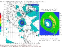
Ok, it's moving VERY slow, but appears will miss the Yucatan to the east. BAD NEWS! It's starting to get cooler up our way, which I think will cause Wilma to roll east across lower Florida. Think about next week with probably a billion dollars worth of boats literally rafted up in Ft. Lauderdale for the boat show - the damage could be awfull. Wilma could wipe out most of the "boats for sale" inventory with one swoop. This may not be pretty.
Tom
 
The 12Z GFS run is VERY BAD NEWS guys.

It puts this thing basically over Miami (attacking from the SW) in roughly 6 days. Let's see.... that'd be... SUNDAY.

Oh oh. Let's hope not. There would not be a snowball's chance in hell for the boats at the show to clear out and get to safe harbor in time if this happens.

Go out and blow REAL HARD guys - anywhere but there on this one....
 
well, the 5pm discussion ends on this not very nice prospect :

"EXCEPT THAT BY THE VERY END OF THE FORECAST PERIOD WILMA
IS EXPECTED TO BE ENCOUNTERING WESTERLY FLOW IN THE GULF OF MEXICO
THAT SHOULD FORCE A FAIRLY SHARP RIGHT TURN. HOW SHARP A TURN WILMA
TAKES IS OBVIOUSLY OF INTEREST TO ALL ALONG THE EASTERN GULF OF
MEXICO...BUT IT IS FAR TOO EARLY TO IDENTIFY SPECIFIC AREAS AT
GREATEST RISK."

i hate late season storms, they are usually unpredictable!
 
The nightmare scenario is a run up the Keys from Key West to off Ft. Lauderdale, just offshore. It won't weaken due to interaction with land and will be over the gulf stream - with warm water - basically all the way.

Were I having a boat in that general area (anywhere from Tampa to Jupiter Inlet, roughly) I'd be figuring out NOW what I'm going to do if this beast starts coming my way - especially if I were around the Miami-Ft. Lauderdale area, which will be an absolute ape-zoo with all the temporary docks and such set up over there.

Climatology this time of year favors a ENE to NNE path once this thing gets into the gulf.
 
Wow, have you seen the latest computer models - all models now have Wilma going into the keys or south Florida Sunday or Monday. The westerlys are picking her up pretty quickly in the channel between Yucatan and Cuba as a Cat III storm, and whipping her to the east. It's going to move quickly after it turns east. Looks bad!
Tom
 
Yes - looks very bad indeed..... that's why I sounded the alarm here.... quite concerned, especially if the track is more to the south with the show this weekend.
 
The Ft Lauderdale show is 10/27-10/31. Not sure how early things get set up, but I would think most vendors would wait to see what Wilma does. Any significant storm in this area would be of great concern due to the dense population of people. The dense population of boats makes it that much harder to find a safe place to hide from the storm. Good luck to all in the area and lets hope this thing turns further east and doesn't get too strong.

Jack Sardina
 
Ah, ok, I thought it was THIS weekend.

I expect that this storm will be clear of Florida by the end of this weekend. However whether it has significant impact on the show area of course depends on where it goes.

If you're anywhere from Cedar Key to the East Coast of Florida pay extremely close attention - all the dynamic models are showing EXTREMELY RAPID motion once the storm comes around Cuba - on the order of 20kts - which means that you could have less than 24 hours of warning from that time until impact, and that small divergences in the track could leave you with little or no effective warning to react to the storm.

Were I in the Keys or the West Coast I'd be making plans to secure my boat NOW, and execute those plans and be secure no later than Friday morning, or even Thursday evening if I was in the Keys somewhere. Some of the most recent model runs have this beast tracking up the Keys from Key West towards the mainland, and if that path was to come to pass with a 20kt forward speed there would be less than 12 hours warning from the time the storm comes around Cuba until you had tropical storm force winds in Key West!

I do not have a personal prognostication for exactly where this one is going to go right now, although I see no reason to disagree with the official track in general. There is a SMALL chance that this storm could pull a Mitch and go into the Yucatan, but I don't think so - the upper air environment looks pretty might spot-on to produce the expected motion, although the exact amount of "bend" as it comes around Cuba is open to debate.

This particular storm is going to be extremely dangerous not so much for her intensity and size (although both look to be quite impressive - I would not be surprised to see a Cat 3 at landfall, although the more likely intensity is from a strong Cat 1 to a Middling 2, and in terms of size the windfield dispersion looks to be pretty comparable to Ivan!) but rather due to the forward speed as it approaches the coast - you have to add that forward speed to the windfield speed if you on the "dirty" side of the storm, and this will also significantly enhance surge effects.

Be careful out there folks - I don't want to hear about any wrecked Hatts!
 
2 AM Advisory: 150mph, 901mb, and forecast to be a Cat 5. Wilma wants into the NHC hall of fame. Hopefully I can arrange a haul out in the morning. Best of luck everyone :(
 
5 AM advisory ... 175 MPH winds ... our thoughts and prayers are with all you guys and gals in the path!
 
Did they say 881 mb? Oh my!
Tom
 
They did indeed. 881..... :eek:
 
That's what they said unofficially. They want to calibrate their instruments when the hurricane hunter gets back. Things do not look good for us over here on the southeast coast. I will be starting preparations today and secure ELECTRA on Friday.
 
Sorry, its 882 (confirmed) in the 8 AM.

The good news is that these winds are confined to within 15nm of the center.

The bad news is that the windfield is certain to expand bigtime as a consequence of this deepening. While she won't hold that intensity, if this thing rakes the Keys its going to be catastrophic - although my personal "best guess" is more northward.

Get your act together NOW for this beast - when it heads towards Florida you will have little time before it hits.
 
Weather Channel: Wilma is most intense Storm on Record!

This is a copy & paste from the 9:00am Weather Channel Hurricane Central. This is seriously not good!

Weather Channel -Hurricane Central, 0900:
It's been confirmed: Hurricane Wilma, with a pressure of 882 mb, is the most intense hurricane on record in the Atlantic Basin. Wilma, after undergoing a stunning intensifcation overnight, is now a catastrophic Category 5 hurricane packing sustained winds of 175 mph. The eye of the violent storm is now following a wobbling WNW track through the western Caribbean with a turn toward the NW expected within the next 24 hours.

Fluctuations in intensity are likely, but Wilma is forecast to remain an extremely dangerous Category 5 hurricane through Thursday. The projected track of the storm takes it through the Yucatan Channel into the extreme southern Gulf of Mexico Friday night. After that, Wilma is expected to come under the influence of westerly winds aloft blowing across the Gulf. That should hurl the hurricane toward the Florida Peninsula, probably the southern part of the peninsula, this weekend. Wilma is expected to be weakening by then, but weakening is a relative term and Wilma may still be a major hurricane (winds over 110 mph) when it makes landfall.


p.s. After posting, I found myself staring at the words in utter disbelief. 175 MPH Hurricane?!! A tornado is only a bit more at 200 MPH! What gives with these weather patterns? You folks in the possible path, make preperations now.
 
Last edited:
Good luck to all in its path.

Remember, if your gonna’ stay in your slip use the longest lines possible and double them up. Use many attachment points to spread the load out.

We’ll be thinking of you…
 
An <F3> tornado is roughly equivalent to a Cat 5 hurricane.

A F1 tornado is the hurricane boundary.

Most tornados are F0, F1 and F2 events. F3s are uncommon, F4s are rare, and F5s.... well, as was said in Twister - "The Finger of God" (and not the one up on high, but the one down below!)

My biggest fear with this storm is not the windspeed - it is going to be the forward speed once it makes the corner. Normally, you can check updates daily and be reasonably safe, as you usually get 2, 3 or more days warning. This will not be the case here - you'll be lucky to get 24 hours from the time that a reasonably-coherent strike location is determined until it happens.
 

Forum statistics

Threads
38,155
Messages
448,720
Members
12,482
Latest member
UnaVida

Latest Posts

Trending content

Back
Top Bottom