Sam's is your source for Hatteras and Cabo Yacht parts.
You are using an out of date browser. It may not display this or other websites correctly.
You should upgrade or use an alternative browser.
You should upgrade or use an alternative browser.
yOU mE AND iRENE
- Thread starter rsmith
- Start date
- Replies 171
- Views 50,366
bobk
Legendary Member
- Joined
- Aug 27, 2005
- Messages
- 4,097
- Status
- OWNER - I own a Hatteras Yacht
- Hatteras Model
- 48' MOTOR YACHT-Series I (1981 - 1984)
hmmmm


Can you send us the links to the various model runs? I used to get them, but something has changed.
Thanks,
Bobk
SeaEric
Legendary Member
- Joined
- Apr 27, 2005
- Messages
- 4,370
- Status
- OWNER - I own a Hatteras Yacht
- Hatteras Model
- 41' TWIN CABIN (1965 - 1971)
Try this: http://www.stormpulse.com/ Then click on Tropical Storm Irene, then click the button to "on" for the Forecast Models.
rsmith
Legendary Member
- Joined
- Mar 21, 2010
- Messages
- 6,322
- Status
- OWNER - I own a Hatteras Yacht
- Hatteras Model
- 50' CONV -Series I (1966 - 1969)
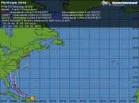
I like this guys site the best it is a composite of all the pertinant charts all in one place.
http://www.spaghettimodels.com/
http://www.spaghettimodels.com/
Jaxfishgyd
Legendary Member
- Joined
- Jun 2, 2005
- Messages
- 2,442
- Hatteras Model
- 43' DOUBLE CABIN (1970 - 1984)
keep turning East Irene !!! now to be a cat 3 when it passes 'well away from jacksonville"..
Mike36c
Well-known member
- Joined
- Apr 12, 2005
- Messages
- 731
- Hatteras Model
- 36' CONVERTIBLE-Series I (1969 -1977)
Keep pushing that track east! Except my plane is tied down at Walker's Cay and I'm 5000 miles away, no way to get it out. My buddy just flew over a load of friends to run their boats home in prep for the storm.
Robby
Well-known member
- Joined
- Mar 31, 2009
- Messages
- 845
- Status
- OWNER - I own a Hatteras Yacht
- Hatteras Model
- 53' MOTOR YACHT (1969 - 1988)
Where and what is the airplane ?I go get it for you!!!!Keep pushing that track east! Except my plane is tied down at Walker's Cay and I'm 5000 miles away, no way to get it out. My buddy just flew over a load of friends to run their boats home in prep for the storm.
Angela
Legendary Member
- Joined
- Jul 8, 2005
- Messages
- 3,879
- Status
- OWNER - I own a Hatteras Yacht
- Hatteras Model
- 58' MOTOR YACHT-Series I (1977 - 1980)
Because at 5PM today, Marathon was out of the cone. As a cautionary measure, I'm waiting on a call from Conrad - he's on his way up the river with a boat tonight and his own boat tomorrow morning, but he's stuck at a bridge that won't open, and there are 18 boats stacked up behind him. If they have room up there for a 58-footer, I'm going to seriously consider taking it and move the boat tomorrow. I don't see the 8PM models up yet.
I did get the genny back up on her feet again.
I did get the genny back up on her feet again.
rsmith
Legendary Member
- Joined
- Mar 21, 2010
- Messages
- 6,322
- Status
- OWNER - I own a Hatteras Yacht
- Hatteras Model
- 50' CONV -Series I (1966 - 1969)
Because at 5PM today, Marathon was out of the cone. As a cautionary measure, I'm waiting on a call from Conrad - he's on his way up the river with a boat tonight and his own boat tomorrow morning, but he's stuck at a bridge that won't open, and there are 18 boats stacked up behind him. If they have room up there for a 58-footer, I'm going to seriously consider taking it and move the boat tomorrow. I don't see the 8PM models up yet.
I did get the genny back up on her feet again.
I wouldnt pull the trigger just yet I kinda think you guys down south will be in the clear.
Pascal
Legendary Member
- Joined
- Mar 28, 2005
- Messages
- 10,258
- Status
- OWNER - I own a Hatteras Yacht
- Hatteras Model
- 53' MOTOR YACHT (1969 - 1988)
Those spaghetti graphs don't mean much unless you have the skills to interpret them... That s what the NHC does and they do a far better job than us...Another example of to much information...
The concern right now is that the forecast is no longer shifting east increasing the risks for the carolinas. If i was anywhere from charleston to cape Hatt, I d start making plans unless things start shifting tomorrow
Right now we re not even looking at anything over minimal tropical storm strength in so Fl...
Forum statistics
Latest Posts
-
-
Any recent advice on how to retrofit Cruisair Split units
- Started by Cap'n Kirk
- Replies: 7
-
-
-


